Import a GPX file

Shrewsbury trails

Click on a trail to view its statistics, map and profile.
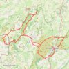
Longmynd Hike 50 miles

United Kingdom > England > Shropshire > Church Stretton > All Stretton

Distance: 48.4 mi • Elevation gain: 8,730 ft • Maximum elevation: 1,729 ft

Bostall Woods to Shrewsbury Park Loop

United Kingdom > England > London

Loop hike from Bostall Woods to Shrewsbury Park via Great Bartletts Woods, Winn Common and Rockliffe Gardens. #Hiking #Loop #City #Nature #Park #Forest

Distance: 4.4 mi • Elevation gain: 364 ft • Maximum elevation: 364 ft

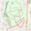
Camp Wunnegan trails

United States > Massachusetts > Worcester County > Shrewsbury

Distance: 2.7 mi • Elevation gain: 217 ft • Maximum elevation: 489 ft

Shrewsbury Park

United Kingdom > England > London

Morning Walk

Distance: 4.6 mi • Elevation gain: 397 ft • Maximum elevation: 305 ft

Gear up for your next adventure:

🛰️Satellite Messengers - Emergency SOS and two-way messaging for off-grid adventures
🪶Wildlife Field Guides - Learn animal tracking and species ID
💧Water Filtration Bottles - Safely drink from streams and lakes while exploring
📚USA Hiking Guide Books - Top trail guides and map books
🎁Geography Themed Gifts - Unique gift ideas for map lovers and geography enthusiasts

As an Amazon Associate, this site earns from qualifying purchases at no extra cost to you.