
Thermal trails
Click on a trail to view its statistics, map and profile.
Otumuheke Thermal Waters
New Zealand > Waikato > Taupo District > Taupō
Distance: 1.0 mi • Elevation gain: 82 ft • Maximum elevation: 1,247 ft
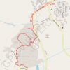
Mammoth Hot Springs Loop
United States > Wyoming > Park County > Mammoth
Starting near the Albright Visitor Center in Yellowstone National Park, this loop follows Grand Loop Road toward Palette Spring, where steaming runoff, warm mineral colors and open views introduce the Mammoth Hot Springs landscape. The route then crosses the Mammoth Terraces through Jupiter Terrace, Mound…
Distance: 2.8 mi • Elevation gain: 430 ft • Maximum elevation: 6,591 ft