MacDonald Forest Trail Run 50K 2026
- Distance: 32.6 mi
- Elevation gain: 7,221 ft
- Maximum elevation: 2,113 ft
- Elevation loss: 7,218 ft
- Minimum elevation: 535 ft
- Moving time: 5 h 8 m
- Moving speed: 6.3 mph
- Maximum speed: 24.9 mph
- Total time: 5 h 11 m
- Global speed: 6.3 mph
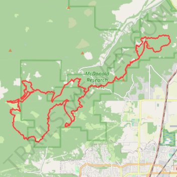
Interactive trail map
Trail profile
- Distance: 32.6 mi
- Elevation gain: 7,221 ft
- Maximum elevation: 2,113 ft
- Elevation loss: 7,218 ft
- Minimum elevation: 535 ft
- Moving time: 5 h 8 m
- Moving speed: 6.3 mph
- Maximum speed: 24.9 mph
- Total time: 5 h 11 m
- Global speed: 6.3 mph
About this trail
Name: MacDonald Forest Trail Run 50K 2026 trail, distance, elevation, map, profile, GPS track
Start: John H. Beuter Road, Benton County, Oregon, United States (44.66034 -123.23815)
End: John H. Beuter Road, Benton County, Oregon, United States (44.66017 -123.23850)
Coordinates: 44.60599 -123.36409 44.66456 -123.23799
Topography: Benton County topographic map, elevation, terrain
Other hiking, mountain biking, running and outdoor activity trails
Click on a trail to view its statistics, map and profile.
McCulloch Peak Loop Hike in McDonald Forest
United States > Oregon > Benton County
Distance: 9.3 mi • Elevation gain: 2,205 ft • Maximum elevation: 2,113 ft
Trails and roads around Dunn Forest
United States > Oregon > Benton County
Distance: 27.1 mi • Elevation gain: 4,974 ft • Maximum elevation: 1,873 ft