Great Divide Trail North Racehorse Creek to Dutch Creek Tornado Pass
- Distance: 9.5 mi
- Elevation gain: 1,998 ft
- Maximum elevation: 6,476 ft
- Elevation loss: 1,631 ft
- Minimum elevation: 5,564 ft
- Moving time: 4 h 26 m
- Moving speed: 2.1 mph
- Maximum speed: 5.9 mph
- Total time: 4 h 26 m
- Global speed: 2.1 mph
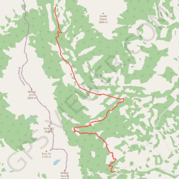
Interactive trail map
Trail profile
- Distance: 9.5 mi
- Elevation gain: 1,998 ft
- Maximum elevation: 6,476 ft
- Elevation loss: 1,631 ft
- Minimum elevation: 5,564 ft
- Moving time: 4 h 26 m
- Moving speed: 2.1 mph
- Maximum speed: 5.9 mph
- Total time: 4 h 26 m
- Global speed: 2.1 mph
About this trail
Name: Great Divide Trail North Racehorse Creek to Dutch Creek Tornado Pass trail, distance, elevation, map, profile, GPS track
Start: Municipal District of Ranchland No. 66, Alberta, Canada (49.85362 -114.62822)
End: Municipal District of Ranchland No. 66, Alberta, Canada (49.92540 -114.66893)
Coordinates: 49.85344 -114.66918 49.92540 -114.62269
Other hiking, mountain biking, running and outdoor activity trails
Click on a trail to view its statistics, map and profile.
Great Divide Trail Window Mountain Lake to North Racehorse Creek
Canada > Alberta > Municipal District of Ranchland No. 66
Distance: 11.6 mi • Elevation gain: 3,035 ft • Maximum elevation: 7,352 ft