Bear Island Loop via Chesapeake and Ohio Canal Trail and Billy Goat Trail
The Bear Island Loop offers hikers a dynamic mix of terrain with scenic views of the Potomac River. Along the route, you'll encounter sections of peaceful canal pathways, rugged rock scrambles, and sweeping vistas of Mather Gorge. The trail's natural beauty is complemented by opportunities for exploration, from observing rapids and kayakers to enjoying a sandy beach area near the river. It’s a well-loved hike for those looking to challenge themselves with rocky terrain while also being rewarded with breathtaking scenery. #Hiking #Loop #River #Rock #Forest #Nature
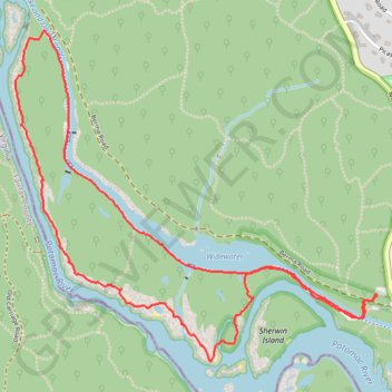
- Distance: 3.8 mi
- Elevation gain: 285 ft
- Maximum elevation: 171 ft
- Elevation loss: 279 ft
- Minimum elevation: 72 ft
- Moving time: 1 h 56 m
- Moving speed: 2.0 mph
- Maximum speed: 4.8 mph
- Total time: 2 h 47 m
- Global speed: 1.4 mph
Interactive trail map
Trail profile
- Distance: 3.8 mi
- Elevation gain: 285 ft
- Maximum elevation: 171 ft
- Elevation loss: 279 ft
- Minimum elevation: 72 ft
- Moving time: 1 h 56 m
- Moving speed: 2.0 mph
- Maximum speed: 4.8 mph
- Total time: 2 h 47 m
- Global speed: 1.4 mph
About this trail
Name: Bear Island Loop via Chesapeake and Ohio Canal Trail and Billy Goat Trail trail, distance, elevation, map, profile, GPS track
Coordinates: 38.97955 -77.24712 38.99349 -77.22742
Topography: Montgomery County topographic map, elevation, terrain
Other hiking, mountain biking, running and outdoor activity trails
Click on a trail to view its statistics, map and profile.
Bear Island Loop via Chesapeake and Ohio Canal Trail and Billy Goat Trail Section A
United States > Maryland > Montgomery County > Potomac
The Bear Island Loop, accessed via the Chesapeake and Ohio Canal Trail and Billy Goat Trail Section A, offers a combination of scenic beauty and challenging terrain. The route starts along the C&O Canal Towpath, where hikers are treated to tranquil water views and glimpses of the surrounding forest. As the…
Distance: 3.9 mi • Elevation gain: 295 ft • Maximum elevation: 184 ft
Great Falls Overlook and Bear Isand Loop via Billy Goat Trail and Chesapeake and Ohio Canal Trail
United States > Maryland > Montgomery County > Potomac
This loop hike offers a diverse experience, combining the rugged adventure of the Billy Goat Trail with the peaceful ambiance of the C&O Canal Trail. The Billy Goat Trail (Section A) is particularly notable for its rock scrambles and dramatic views of the Potomac River and Mather Gorge, providing a thrilling,…
Distance: 5.0 mi • Elevation gain: 299 ft • Maximum elevation: 194 ft
Great Falls Overlook, Billy Goat Trail, and Chesapeak and Ohio Canal Trail Loop
United States > Maryland > Montgomery County
The Great Falls Overlook, Billy Goat Trail, and Chesapeake and Ohio Canal Trail Loop offers hikers a dynamic experience featuring the powerful cascades of Great Falls, the rugged terrain of the Billy Goat Trail with its rock scrambles along Mather Gorge, and the tranquil, historic path of the C&O Canal…
Distance: 4.5 mi • Elevation gain: 282 ft • Maximum elevation: 184 ft
Great Falls Overlook via Chesapeake and Ohio Canal Trail
United States > Maryland > Montgomery County > Potomac
The Chesapeake and Ohio Canal Trail offers a delightful mix of historical and natural features, making it an appealing hike for those in the Potomac area. The trail leads to an exceptional vantage point, where hikers can witness the dramatic Great Falls, where the Potomac River drops over 60 feet, creating a…
Distance: 4.2 mi • Elevation gain: 233 ft • Maximum elevation: 154 ft