Make a donation
Gear up for your next adventure:
As an Amazon Associate, this site earns from qualifying purchases at no extra cost to you.
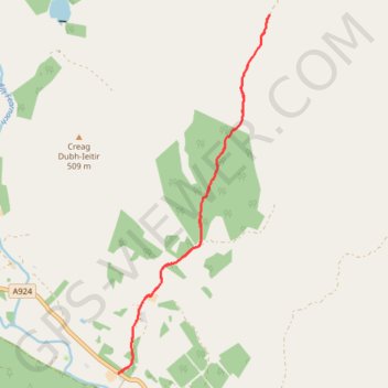
Enochdhu to Upper Lunch Hut Loop
Mountain Bike Ride
- Distance: 6.7 mi
- Elevation gain: 863 ft
- Maximum elevation: 1,575 ft
- Elevation loss: 863 ft
- Minimum elevation: 837 ft
- Moving time: 1 h 8 m
- Moving speed: 5.9 mph
- Maximum speed: 12.1 mph
- Total time: 1 h 19 m
- Global speed: 5.1 mph
Interactive trail map
Make a donation
Gear up for your next adventure:
As an Amazon Associate, this site earns from qualifying purchases at no extra cost to you.
Trail profile
- Distance: 6.7 mi
- Elevation gain: 863 ft
- Maximum elevation: 1,575 ft
- Elevation loss: 863 ft
- Minimum elevation: 837 ft
- Moving time: 1 h 8 m
- Moving speed: 5.9 mph
- Maximum speed: 12.1 mph
- Total time: 1 h 19 m
- Global speed: 5.1 mph
Make a donation
Gear up for your next adventure:
As an Amazon Associate, this site earns from qualifying purchases at no extra cost to you.
About this trail
Name: Enochdhu to Upper Lunch Hut Loop trail, distance, elevation, map, profile, GPS track
Start: A924, Enochdhu, Perth and Kinross, Scotland, PH10 7PE, United Kingdom (56.74747 -3.53500)
End: A924, Enochdhu, Perth and Kinross, Scotland, PH10 7PE, United Kingdom (56.74738 -3.53484)
Coordinates: 56.74738 -3.53500 56.78847 -3.50338
Make a donation
Gear up for your next adventure:
As an Amazon Associate, this site earns from qualifying purchases at no extra cost to you.
Other hiking, mountain biking, running and outdoor activity trails
Click on a trail to view its statistics, map and profile.
Alyth to Spittal of Glenshee - Cateran Trail (some of)
United Kingdom > Scotland > Perth and Kinross > Alyth
Distance: 27.4 mi • Elevation gain: 3,720 ft • Maximum elevation: 2,133 ft
Around Kirkmichael, Perthshire
United Kingdom > Scotland > Perth and Kinross > Kirkmichael
Distance: 4.8 mi • Elevation gain: 289 ft • Maximum elevation: 899 ft