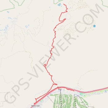
Vail to Lost Lake
Morning Ride
lost, lake, vail, lostlake, lake, trail, foresttrail, forest, road, trail, hike, bike
- Distance: 12.8 mi
- Elevation gain: 2,799 ft
- Maximum elevation: 10,144 ft
- Elevation loss: 856 ft
- Minimum elevation: 7,979 ft
- Moving time: 2 h 13 m
- Moving speed: 5.7 mph
- Maximum speed: 27.8 mph
- Total time: 3 h 33 m
- Global speed: 3.6 mph
Interactive trail map
Trail profile
- Distance: 12.8 mi
- Elevation gain: 2,799 ft
- Maximum elevation: 10,144 ft
- Elevation loss: 856 ft
- Minimum elevation: 7,979 ft
- Moving time: 2 h 13 m
- Moving speed: 5.7 mph
- Maximum speed: 27.8 mph
- Total time: 3 h 33 m
- Global speed: 3.6 mph
About this trail
Name: Vail to Lost Lake trail, distance, elevation, map, profile, GPS track
End: Lost Lake Trail #2, Eagle County, Colorado, United States (39.71376 -106.38460)
Coordinates: 39.63179 -106.41641 39.71381 -106.37347
Topography: Eagle County topographic map, elevation, terrain
Other hiking, mountain biking, running and outdoor activity trails
Click on a trail to view its statistics, map and profile.