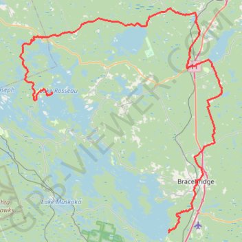
Lake Muskoka - Lake Rosseau
#Bike
- Distance: 65.6 mi
- Elevation gain: 4,245 ft
- Maximum elevation: 1,129 ft
- Elevation loss: 4,252 ft
- Minimum elevation: 732 ft
Interactive trail map
Trail profile
- Distance: 65.6 mi
- Elevation gain: 4,245 ft
- Maximum elevation: 1,129 ft
- Elevation loss: 4,252 ft
- Minimum elevation: 732 ft
About this trail
Name: Lake Muskoka - Lake Rosseau trail, distance, elevation, map, profile, GPS track
Coordinates: 44.96372 -79.68444 45.29987 -79.25529
Other hiking, mountain biking, running and outdoor activity trails
Click on a trail to view its statistics, map and profile.