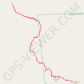
Mountt Arab trail
Arab Mountain
- Distance: 2.4 mi
- Elevation gain: 741 ft
- Maximum elevation: 2,510 ft
- Elevation loss: 748 ft
- Minimum elevation: 1,791 ft
- Moving time: 1 h 19 m
- Moving speed: 1.8 mph
- Maximum speed: 2.7 mph
- Total time: 1 h 56 m
- Global speed: 1.3 mph
Interactive trail map
Trail profile
- Distance: 2.4 mi
- Elevation gain: 741 ft
- Maximum elevation: 2,510 ft
- Elevation loss: 748 ft
- Minimum elevation: 1,791 ft
- Moving time: 1 h 19 m
- Moving speed: 1.8 mph
- Maximum speed: 2.7 mph
- Total time: 1 h 56 m
- Global speed: 1.3 mph
About this trail
Name: Mountt Arab trail trail, distance, elevation, map, profile, GPS track
Coordinates: 44.20418 -74.59607 44.21366 -74.58563
Topography: Saint Lawrence County topographic map, elevation, terrain
Other hiking, mountain biking, running and outdoor activity trails
Click on a trail to view its statistics, map and profile.