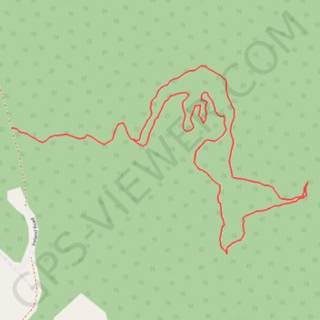
East of Old Ireland Road
Henniker Running
- Distance: 2.2 mi
- Elevation gain: 312 ft
- Maximum elevation: 873 ft
- Elevation loss: 410 ft
- Minimum elevation: 482 ft
- Moving time: 54 m 3 s
- Moving speed: 2.4 mph
- Maximum speed: 5.3 mph
- Total time: 54 m 3 s
- Global speed: 2.4 mph
Interactive trail map
Trail profile
- Distance: 2.2 mi
- Elevation gain: 312 ft
- Maximum elevation: 873 ft
- Elevation loss: 410 ft
- Minimum elevation: 482 ft
- Moving time: 54 m 3 s
- Moving speed: 2.4 mph
- Maximum speed: 5.3 mph
- Total time: 54 m 3 s
- Global speed: 2.4 mph
About this trail
Name: East of Old Ireland Road trail, distance, elevation, map, profile, GPS track
Start: Ireland Road, Henniker, Merrimack County, New Hampshire, 03242, United States (43.14754 -71.74732)
End: Ireland Road, Henniker, Merrimack County, New Hampshire, 03242, United States (43.14786 -71.75228)
Coordinates: 43.14411 -71.75228 43.14971 -71.74019
Topography: Merrimack County topographic map, elevation, terrain
Other hiking, mountain biking, running and outdoor activity trails
Click on a trail to view its statistics, map and profile.