Westerdale Kildale Loop
Scarborough Mountain Biking
- Distance: 12.1 mi
- Elevation gain: 1,988 ft
- Maximum elevation: 1,119 ft
- Elevation loss: 1,988 ft
- Minimum elevation: 492 ft
- Moving time: 1 h 43 m
- Moving speed: 7.0 mph
- Maximum speed: 31.7 mph
- Total time: 2 h 14 m
- Global speed: 5.4 mph
Interactive trail map
Trail profile
- Distance: 12.1 mi
- Elevation gain: 1,988 ft
- Maximum elevation: 1,119 ft
- Elevation loss: 1,988 ft
- Minimum elevation: 492 ft
- Moving time: 1 h 43 m
- Moving speed: 7.0 mph
- Maximum speed: 31.7 mph
- Total time: 2 h 14 m
- Global speed: 5.4 mph
About this trail
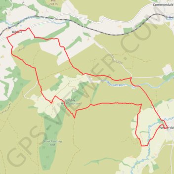
Name: Westerdale Kildale Loop trail, distance, elevation, map, profile, GPS track
Coordinates: 54.43766 -1.06996 54.47760 -0.97629
Other hiking, mountain biking, running and outdoor activity trails
Click on a trail to view its statistics, map and profile.
Church Houses Loop Mountain Biking
United Kingdom > England > North Yorkshire > Church Houses
Distance: 14.3 mi • Elevation gain: 2,116 ft • Maximum elevation: 1,289 ft
Westerdale top
United Kingdom > England > North Yorkshire > Westerdale
Mountain Biking
Distance: 17.0 mi • Elevation gain: 2,175 ft • Maximum elevation: 1,385 ft