Trail of Ten Falls in Silver Falls State Park
The Trail of Ten Falls in Silver Falls State Park offers a spectacular journey through lush forested landscapes, where you'll encounter several dramatic waterfalls along the way. The trail provides opportunities to walk behind multiple falls, including the impressive South Falls, and lesser-known gems like Middle North Falls and Double Falls, which cascade down basalt cliffs. This moderately challenging hike features varied terrain, with sections offering serene creek views, misty trails near waterfalls, and opportunities for peaceful, secluded moments away from the main crowds. #Hiking #Loop #Waterfall #River #Canyon #Overlook #Forest #Nature
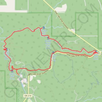
- Distance: 9.1 mi
- Elevation gain: 2,306 ft
- Maximum elevation: 1,624 ft
- Elevation loss: 2,306 ft
- Minimum elevation: 1,053 ft
Interactive trail map
Trail profile
- Distance: 9.1 mi
- Elevation gain: 2,306 ft
- Maximum elevation: 1,624 ft
- Elevation loss: 2,306 ft
- Minimum elevation: 1,053 ft
About this trail
Name: Trail of Ten Falls in Silver Falls State Park trail, distance, elevation, map, profile, GPS track
Start: Rim Trail, Marion County, Oregon, United States (44.87943 -122.65668)
End: Rim Trail, Marion County, Oregon, United States (44.87769 -122.65573)
Coordinates: 44.87769 -122.66238 44.89218 -122.62116
Topography: Marion County topographic map, elevation, terrain
Other hiking, mountain biking, running and outdoor activity trails
Click on a trail to view its statistics, map and profile.
Perimeter Trail and Roemer's Meadow Trail
United States > Oregon > Marion County > Drake Crossing
Distance: 4.4 mi • Elevation gain: 823 ft • Maximum elevation: 1,995 ft
Trail of Ten Falls Loop via Canyon Trail and Rim Trail in Silver Falls State Park
United States > Oregon > Marion County
The Loop Trail of Ten Falls offers an iconic hiking experience with ten picturesque waterfalls along the way. Starting at South Falls, the tallest and one of the most iconic on the route, you'll pass behind its cascading waters before heading to Lower South Falls, another waterfall you can walk behind. The…
Distance: 7.4 mi • Elevation gain: 1,814 ft • Maximum elevation: 1,660 ft
Silver Falls
United States > Oregon > Marion County
Round trip. #Hiking
Distance: 8.6 mi • Elevation gain: 2,011 ft • Maximum elevation: 1,650 ft