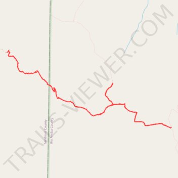
San Jose Trail in San Pedro Parks Wilderness
- Distance: 9.2 mi
- Elevation gain: 2,087 ft
- Maximum elevation: 10,318 ft
- Elevation loss: 2,083 ft
- Minimum elevation: 8,688 ft
- Moving time: 4 h 31 m
- Moving speed: 2.0 mph
- Maximum speed: 4.7 mph
- Total time: 7 h 2 m
- Global speed: 1.3 mph
Interactive trail map
Trail profile
- Distance: 9.2 mi
- Elevation gain: 2,087 ft
- Maximum elevation: 10,318 ft
- Elevation loss: 2,083 ft
- Minimum elevation: 8,688 ft
- Moving time: 4 h 31 m
- Moving speed: 2.0 mph
- Maximum speed: 4.7 mph
- Total time: 7 h 2 m
- Global speed: 1.3 mph
About this trail
Name: San Jose Trail in San Pedro Parks Wilderness trail, distance, elevation, map, profile, GPS track
Start: San Jose Road, Sandoval County, New Mexico, 87027, United States (36.15515 -106.89774)
End: San Jose Road, Sandoval County, New Mexico, 87027, United States (36.15550 -106.89717)
Coordinates: 36.13843 -106.89774 36.15574 -106.85260
Topography: Sandoval County topographic map, elevation, terrain
Other hiking, mountain biking, running and outdoor activity trails
Click on a trail to view its statistics, map and profile.
San Pedro Parks Wilderness backpack
United States > New Mexico > Rio Arriba County
Distance: 14.7 mi • Elevation gain: 1,837 ft • Maximum elevation: 10,482 ft