Make a donation
Gear up for your next adventure:
As an Amazon Associate, this site earns from qualifying purchases at no extra cost to you.
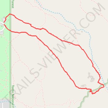
Treasure Loop Trail in Tonto National Forest
The Treasure Loop Trail in Tonto National Forest offers hikers a scenic journey through the Sonoran Desert, featuring expansive vistas of the Superstition Mountains and the Goldfield Mountains. Along the path, you can observe diverse cacti species, including saguaro and prickly pear, set against a backdrop of rugged desert terrain, and, during spring, vibrant wildflowers. The trail also provides vistas of the historic Goldfield Ghost Town, adding a touch of the Old West to your hike. #Hiking #Loop #Desert #Nature
- Distance: 2.4 mi
- Elevation gain: 538 ft
- Maximum elevation: 2,638 ft
- Elevation loss: 535 ft
- Minimum elevation: 2,100 ft
- Moving time: 1 h 2 m
- Moving speed: 2.3 mph
- Maximum speed: 4.4 mph
- Total time: 1 h 10 m
- Global speed: 2.0 mph
Interactive trail map
Make a donation
Gear up for your next adventure:
As an Amazon Associate, this site earns from qualifying purchases at no extra cost to you.
Trail profile
- Distance: 2.4 mi
- Elevation gain: 538 ft
- Maximum elevation: 2,638 ft
- Elevation loss: 535 ft
- Minimum elevation: 2,100 ft
- Moving time: 1 h 2 m
- Moving speed: 2.3 mph
- Maximum speed: 4.4 mph
- Total time: 1 h 10 m
- Global speed: 2.0 mph
Make a donation
Gear up for your next adventure:
As an Amazon Associate, this site earns from qualifying purchases at no extra cost to you.
About this trail
Name: Treasure Loop Trail in Tonto National Forest trail, distance, elevation, map, profile, GPS track
Start: Treasure Loop #56, Pinal County, Arizona, United States (33.46065 -111.47772)
End: Youngberg, Pinal County, Arizona, United States (33.46041 -111.47773)
Coordinates: 33.45205 -111.47773 33.46164 -111.46332
Topography: Pinal County topographic map, elevation, terrain
Make a donation
Gear up for your next adventure:
As an Amazon Associate, this site earns from qualifying purchases at no extra cost to you.
Other hiking, mountain biking, running and outdoor activity trails
Click on a trail to view its statistics, map and profile.
Massacre Falls Trail in Tonto National Forest and Superstition Wilderness
United States > Arizona > Maricopa County
Massacre Falls Trail in Tonto National Forest and Superstition Wilderness offers hikers a journey through desert landscapes adorned with seasonal wildflowers and panoramic mountain vistas. The trail leads to Massacre Falls, a seasonal waterfall best viewed after rainfall or during snowmelt periods. Along the…
Distance: 5.3 mi • Elevation gain: 1,161 ft • Maximum elevation: 3,271 ft
The Flatiron via Siphon Draw Trail in Tonto National Forest
United States > Arizona > Pinal County > Youngberg
The Flatiron via Siphon Draw Trail offers a challenging and rewarding hiking experience within the stunning Superstition Mountains of Tonto National Forest. The route begins with a rocky ascent through exposed terrain, gradually drawing you closer to the dramatic Flatiron peak, which stands out like the bow of…
Distance: 5.7 mi • Elevation gain: 2,740 ft • Maximum elevation: 4,672 ft
Make a donation
Gear up for your next adventure:
As an Amazon Associate, this site earns from qualifying purchases at no extra cost to you.