Clark Creek Primitive Loop Trail in Clark Creek Natural Area
The Clark Creek Primitive Loop Trail offers a rewarding hike through dense hardwood forests and rugged terrain, punctuated by a series of cascading waterfalls. As you navigate steep hills and cross over boulder-strewn creeks, the scenic beauty of loess bluff formations and shaded groves adds to the trail's appeal. While the challenging path and frequent inclines demand effort, the serene creekside views and tranquil spots for a cool dip make it a favorite for adventurous hikers seeking an immersive nature experience. #Hiking #Waterfall #Forest #Nature
- Distance: 4.4 mi
- Elevation gain: 689 ft
- Maximum elevation: 423 ft
- Elevation loss: 689 ft
- Minimum elevation: 157 ft
- Moving time: 2 h 6 m
- Moving speed: 2.1 mph
- Maximum speed: 6.0 mph
- Total time: 2 h 15 m
- Global speed: 2.0 mph
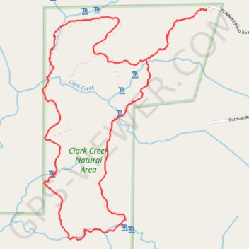
Interactive trail map
Trail profile
- Distance: 4.4 mi
- Elevation gain: 689 ft
- Maximum elevation: 423 ft
- Elevation loss: 689 ft
- Minimum elevation: 157 ft
- Moving time: 2 h 6 m
- Moving speed: 2.1 mph
- Maximum speed: 6.0 mph
- Total time: 2 h 15 m
- Global speed: 2.0 mph
About this trail
Name: Clark Creek Primitive Loop Trail in Clark Creek Natural Area trail, distance, elevation, map, profile, GPS track
Coordinates: 31.05570 -91.52506 31.07173 -91.51172
Topography: Wilkinson County topographic map, elevation, terrain
Other hiking, mountain biking, running and outdoor activity trails
Click on a trail to view its statistics, map and profile.
Clark Creek Improved Trail in Clark Creek Natural Area
United States > Mississippi > Wilkinson County
The Clark Creek Improved Trail offers a delightful hiking experience through lush woodlands and picturesque landscapes. As you traverse the well-maintained paths, you'll encounter numerous cascading waterfalls, which are particularly stunning after rainfall. The trail's accessibility, with gravel paths and…
Distance: 3.0 mi • Elevation gain: 449 ft • Maximum elevation: 427 ft
Clark Creek Improved Loop Trail
United States > Mississippi > Wilkinson County
The Clark Creek Improved Loop Trail is a scenic destination known for its beautiful waterfalls and diverse landscapes. As you hike, you'll encounter well-maintained gravel paths, wooden bridges, and stairways, making it accessible for hikers of all levels while providing opportunities to observe local wildlife…
Distance: 2.9 mi • Elevation gain: 394 ft • Maximum elevation: 427 ft