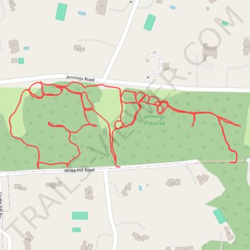
Jennings Preserve
- Distance: 2.1 mi
- Elevation gain: 39 ft
- Maximum elevation: 180 ft
- Elevation loss: 39 ft
- Minimum elevation: 154 ft
- Moving time: 48 m 2 s
- Moving speed: 2.6 mph
- Maximum speed: 4.1 mph
- Total time: 51 m 45 s
- Global speed: 2.4 mph
Interactive trail map
Trail profile
- Distance: 2.1 mi
- Elevation gain: 39 ft
- Maximum elevation: 180 ft
- Elevation loss: 39 ft
- Minimum elevation: 154 ft
- Moving time: 48 m 2 s
- Moving speed: 2.6 mph
- Maximum speed: 4.1 mph
- Total time: 51 m 45 s
- Global speed: 2.4 mph
About this trail
Name: Jennings Preserve trail, distance, elevation, map, profile, GPS track
Coordinates: 40.88150 -73.46317 40.88336 -73.45668
Topography: Suffolk County topographic map, elevation, terrain
Other hiking, mountain biking, running and outdoor activity trails
Click on a trail to view its statistics, map and profile.