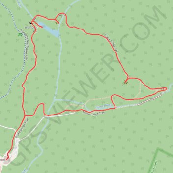
Flume Gorge Loop
Interactive trail map
Trail profile
- Distance: 2.2 mi
- Elevation gain: 535 ft
- Maximum elevation: 1,637 ft
- Elevation loss: 535 ft
- Minimum elevation: 1,280 ft
About this trail
Name: Flume Gorge Loop trail, distance, elevation, map, profile, GPS track
Coordinates: 44.09710 -71.67993 44.10459 -71.66853
Topography: Grafton County topographic map, elevation, terrain
Other hiking, mountain biking, running and outdoor activity trails
Click on a trail to view its statistics, map and profile.
Flume Gorge Loop Trail in Franconia Notch State Park
United States > New Hampshire > Grafton County > Lincoln
The Flume Gorge Loop Trail offers a captivating blend of natural beauty and geological wonders. Along the trail, visitors will pass through lush forests, marvel at moss-covered boulders, and witness cascading waterfalls, including the striking Avalanche Falls. The trail’s wooden boardwalks take hikers…
Distance: 2.1 mi • Elevation gain: 495 ft • Maximum elevation: 1,640 ft