Beryl Gaffney Park
Interactive trail map
Trail profile
- Distance: 4.4 mi
- Elevation gain: 200 ft
- Maximum elevation: 299 ft
- Elevation loss: 200 ft
- Minimum elevation: 256 ft
About this trail
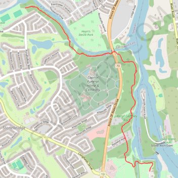
Name: Beryl Gaffney Park trail, distance, elevation, map, profile, GPS track
Coordinates: 45.24725 -75.72280 45.26461 -75.70371
Other hiking, mountain biking, running and outdoor activity trails
Click on a trail to view its statistics, map and profile.
Brockville - Ottawa
Canada > Ontario > Brockville > Brockville
#Bike #Brockville #Ottawa
Distance: 73.6 mi • Elevation gain: 1,230 ft • Maximum elevation: 440 ft