Make a donation
Gear up for your next adventure:
As an Amazon Associate, this site earns from qualifying purchases at no extra cost to you.
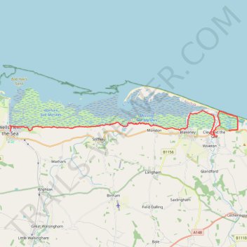
Walk from Wells-next-the-Sea to Cley-next-the-Sea
- Distance: 13.6 mi
- Elevation gain: 187 ft
- Maximum elevation: 49 ft
- Elevation loss: 220 ft
- Minimum elevation: -3 ft
- Moving time: 4 h 46 m
- Moving speed: 2.8 mph
- Maximum speed: 4.4 mph
- Total time: 5 h 49 m
- Global speed: 2.3 mph
Interactive trail map
Make a donation
Gear up for your next adventure:
As an Amazon Associate, this site earns from qualifying purchases at no extra cost to you.
Trail profile
- Distance: 13.6 mi
- Elevation gain: 187 ft
- Maximum elevation: 49 ft
- Elevation loss: 220 ft
- Minimum elevation: -3 ft
- Moving time: 4 h 46 m
- Moving speed: 2.8 mph
- Maximum speed: 4.4 mph
- Total time: 5 h 49 m
- Global speed: 2.3 mph
Make a donation
Gear up for your next adventure:
As an Amazon Associate, this site earns from qualifying purchases at no extra cost to you.
About this trail
Name: Walk from Wells-next-the-Sea to Cley-next-the-Sea trail, distance, elevation, map, profile, GPS track
Coordinates: 52.95141 0.85087 52.96591 1.06506
Make a donation
Gear up for your next adventure:
As an Amazon Associate, this site earns from qualifying purchases at no extra cost to you.
Other hiking, mountain biking, running and outdoor activity trails
Click on a trail to view its statistics, map and profile.
Norfolk Coast Path - Cley to Cromer
United Kingdom > England > Norfolk > North Norfolk > Cley next the Sea
norfolk-coast-path, cley-next-the-sea, weybourne, sheringham, west-runton, east-runton, cromer
Distance: 12.5 mi • Elevation gain: 925 ft • Maximum elevation: 141 ft
Cley next the Sea to Binham Bike Loop
United Kingdom > England > Norfolk > North Norfolk > Cley next the Sea > Newgate
#Bike #Loop #Road #Countryside #Nature
Distance: 28.9 mi • Elevation gain: 1,125 ft • Maximum elevation: 312 ft