Make a donation
Gear up for your next adventure:
As an Amazon Associate, this site earns from qualifying purchases at no extra cost to you.
Eldorado Canyon Trail
Interactive trail map
Make a donation
Gear up for your next adventure:
As an Amazon Associate, this site earns from qualifying purchases at no extra cost to you.
Trail profile
- Distance: 6.0 mi
- Elevation gain: 1,962 ft
- Maximum elevation: 7,106 ft
- Elevation loss: 1,959 ft
- Minimum elevation: 6,102 ft
- Moving time: 1 h 45 m
- Moving speed: 3.4 mph
- Maximum speed: 9.8 mph
- Total time: 1 h 53 m
- Global speed: 3.2 mph
Make a donation
Gear up for your next adventure:
As an Amazon Associate, this site earns from qualifying purchases at no extra cost to you.
About this trail
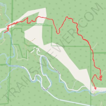
Name: Eldorado Canyon Trail trail, distance, elevation, map, profile, GPS track
Start: Eldorado Springs Drive, Boulder County, Colorado, 80025, United States (39.93096 -105.29395)
End: Eldorado Springs Drive, Boulder County, Colorado, 80025, United States (39.93099 -105.29397)
Coordinates: 39.93096 -105.31593 39.94443 -105.29244
Topography: Boulder County topographic map, elevation, terrain
Make a donation
Gear up for your next adventure:
As an Amazon Associate, this site earns from qualifying purchases at no extra cost to you.
Other hiking, mountain biking, running and outdoor activity trails
Click on a trail to view its statistics, map and profile.
Walker Ranch Loop Trail in Walker Ranch Park
United States > Colorado > Boulder County
The Walker Ranch Loop Trail near Boulder, Colorado, offers hikers a diverse journey through lush forests, open meadows, and along the South Boulder Creek. Along the path, you'll encounter historic remnants of old homesteads, providing a glimpse into the area's past. The trail also features impressive rock…
Distance: 7.6 mi • Elevation gain: 1,673 ft • Maximum elevation: 7,346 ft
Eldorado Canyon Trail
United States > Colorado > Boulder County
The Eldorado Canyon Trail in Colorado offers hikers a rewarding journey through diverse terrains, beginning with a steep ascent that provides panoramic views of the canyon's towering rock formations, often dotted with climbers. As the trail progresses, it winds through shaded forests, leading to a ridge that…
Distance: 6.7 mi • Elevation gain: 2,139 ft • Maximum elevation: 7,110 ft
New Eldorado Canyon bridge
United States > Colorado > Boulder County > Eldorado Springs
Distance: 1.9 mi • Elevation gain: 948 ft • Maximum elevation: 6,870 ft