Walls of Jericho Trail in James D. Martin Skyline Wildlife Management Area
The Walls of Jericho Trail offers a striking and immersive hiking experience. Starting from the Alabama trailhead, the hike is characterized by its challenging descent into a gorge framed by towering limestone cliffs. Along the way, hikers traverse various creek crossings, pass through a historic cemetery, and witness the area's unique limestone formations and seasonal waterfalls. The trail culminates at a natural amphitheater where Turkey Creek emerges dramatically from the base of the bluff. #Hiking #Gorge #River #Waterfall #Forest #Nature
- Distance: 6.6 mi
- Elevation gain: 1,470 ft
- Maximum elevation: 1,778 ft
- Elevation loss: 1,470 ft
- Minimum elevation: 722 ft
- Moving time: 3 h 46 m
- Moving speed: 1.8 mph
- Maximum speed: 6.7 mph
- Total time: 4 h 11 m
- Global speed: 1.6 mph
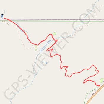
Interactive trail map
Trail profile
- Distance: 6.6 mi
- Elevation gain: 1,470 ft
- Maximum elevation: 1,778 ft
- Elevation loss: 1,470 ft
- Minimum elevation: 722 ft
- Moving time: 3 h 46 m
- Moving speed: 1.8 mph
- Maximum speed: 6.7 mph
- Total time: 4 h 11 m
- Global speed: 1.6 mph
About this trail
Name: Walls of Jericho Trail in James D. Martin Skyline Wildlife Management Area trail, distance, elevation, map, profile, GPS track
Coordinates: 34.97659 -86.10376 34.99008 -86.08054
Topography: Jackson County topographic map, elevation, terrain
Other hiking, mountain biking, running and outdoor activity trails
Click on a trail to view its statistics, map and profile.
Walls of Jericho Hiking Trail
United States > Alabama > Jackson County > Jericho
Distance: 6.7 mi • Elevation gain: 1,509 ft • Maximum elevation: 1,785 ft
Gmaps Pedometer Route
United States > Kentucky > Fulton County > Hickman
Distance: 312.5 mi • Elevation gain: 13,793 ft • Maximum elevation: 1,942 ft