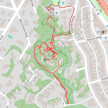
Redwood Grove Nature Preserve
- Distance: 1.4 mi
- Elevation gain: 56 ft
- Maximum elevation: 236 ft
- Elevation loss: 59 ft
- Minimum elevation: 194 ft
- Moving time: 31 m 57 s
- Moving speed: 2.6 mph
- Maximum speed: 9.9 mph
- Total time: 35 m 35 s
- Global speed: 2.3 mph
Interactive trail map
Trail profile
- Distance: 1.4 mi
- Elevation gain: 56 ft
- Maximum elevation: 236 ft
- Elevation loss: 59 ft
- Minimum elevation: 194 ft
- Moving time: 31 m 57 s
- Moving speed: 2.6 mph
- Maximum speed: 9.9 mph
- Total time: 35 m 35 s
- Global speed: 2.3 mph
About this trail
Name: Redwood Grove Nature Preserve trail, distance, elevation, map, profile, GPS track
Coordinates: 37.37107 -122.12055 37.37550 -122.11829
Topography: Santa Clara County topographic map, elevation, terrain