
Los Altos Hills trails
Click on a trail to view its statistics, map and profile.
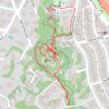
Redwood Grove Nature Preserve
United States > California > Santa Clara County > Los Altos Hills
Distance: 1.4 mi • Elevation gain: 56 ft • Maximum elevation: 236 ft
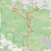
Black Mountain Loop (Rancho San Antonio Open Space Preserve)
United States > California > Santa Clara County > Los Altos Hills
Loop hike to Black Mountain via Rhus Ridge Trail, Black Mountain Trail, Creek Trail, Toyon Trail, Hostel Trail, Hidden Villa, Francemont Drive and Rhus Ridge Road in the Rancho San Antonio Open Space Preserve and Hidden Villa. #Hiking #Loop #Mountain #Nature #Forest
Distance: 12.3 mi • Elevation gain: 3,576 ft • Maximum elevation: 2,805 ft
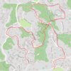
Los Altos Hills trails
United States > California > Santa Clara County > Los Altos Hills
Afternoon Run
Distance: 3.5 mi • Elevation gain: 791 ft • Maximum elevation: 738 ft