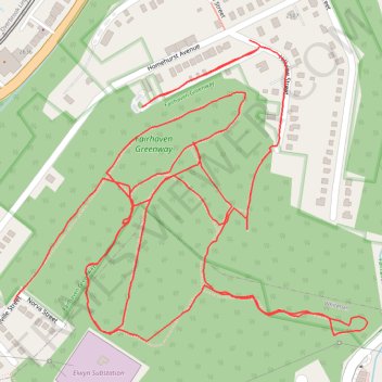
Fairhaven Greenway trails, Overbrook
- Distance: 2.5 mi
- Elevation gain: 371 ft
- Maximum elevation: 1,194 ft
- Elevation loss: 361 ft
- Minimum elevation: 994 ft
- Moving time: 47 m 38 s
- Moving speed: 3.1 mph
- Maximum speed: 10.8 mph
- Total time: 1 h 8 m
- Global speed: 2.2 mph
Interactive trail map
Trail profile
- Distance: 2.5 mi
- Elevation gain: 371 ft
- Maximum elevation: 1,194 ft
- Elevation loss: 361 ft
- Minimum elevation: 994 ft
- Moving time: 47 m 38 s
- Moving speed: 3.1 mph
- Maximum speed: 10.8 mph
- Total time: 1 h 8 m
- Global speed: 2.2 mph
About this trail
Name: Fairhaven Greenway trails, Overbrook trail, distance, elevation, map, profile, GPS track
Coordinates: 40.37529 -80.00157 40.37962 -79.99490
Topography: Pittsburgh topographic map, elevation, terrain
Other hiking, mountain biking, running and outdoor activity trails
Click on a trail to view its statistics, map and profile.