Platte River State Park Loop via Ruthie's Backyard Trail, Stone Creek, Jeanny Newman Lake and East Bound and Down
The Platte River State Park Loop offers hikers a delightful experience with diverse landscapes, from tranquil forests to scenic water views. Notable highlights along the route include Ruthie's Backyard Trail, which provides a gentle introduction to the area, and the charming Stone Creek Falls, where visitors can enjoy a small yet picturesque waterfall surrounded by lush greenery. As you traverse the loop, expect to encounter wildlife and beautiful vistas of both the Platte River and Jeanny Newman Lake, enhancing the overall enjoyment of this natural retreat. #Hiking #Loop #Forest #River #Waterfall #Lake #Nature
- Distance: 7.9 mi
- Elevation gain: 1,161 ft
- Maximum elevation: 1,220 ft
- Elevation loss: 1,165 ft
- Minimum elevation: 1,043 ft
- Moving time: 2 h 55 m
- Moving speed: 2.7 mph
- Maximum speed: 14.8 mph
- Total time: 3 h 7 m
- Global speed: 2.5 mph
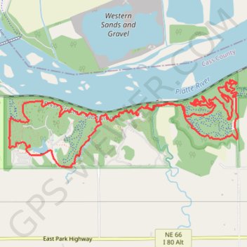
Interactive trail map
Trail profile
- Distance: 7.9 mi
- Elevation gain: 1,161 ft
- Maximum elevation: 1,220 ft
- Elevation loss: 1,165 ft
- Minimum elevation: 1,043 ft
- Moving time: 2 h 55 m
- Moving speed: 2.7 mph
- Maximum speed: 14.8 mph
- Total time: 3 h 7 m
- Global speed: 2.5 mph
About this trail
Name: Platte River State Park Loop via Ruthie's Backyard Trail, Stone Creek, Jeanny Newman Lake and East Bound and Down trail, distance, elevation, map, profile, GPS track
Start: Ruthie's Backyard Trail, Cass County, Nebraska, 68037, United States (40.99218 -96.21124)
End: Ruthie's Backyard Trail, Cass County, Nebraska, 68037, United States (40.99220 -96.21098)
Coordinates: 40.98676 -96.22874 40.99582 -96.19744
Topography: Cass County topographic map, elevation, terrain