Dockey Woods
- Distance: 6.0 mi
- Elevation gain: 492 ft
- Maximum elevation: 823 ft
- Elevation loss: 492 ft
- Minimum elevation: 499 ft
- Moving time: 1 h 20 m
- Moving speed: 4.5 mph
- Maximum speed: 11.0 mph
- Total time: 1 h 24 m
- Global speed: 4.3 mph
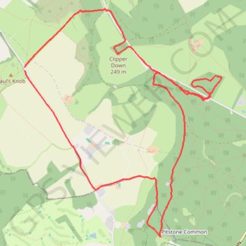
Interactive trail map
Trail profile
- Distance: 6.0 mi
- Elevation gain: 492 ft
- Maximum elevation: 823 ft
- Elevation loss: 492 ft
- Minimum elevation: 499 ft
- Moving time: 1 h 20 m
- Moving speed: 4.5 mph
- Maximum speed: 11.0 mph
- Total time: 1 h 24 m
- Global speed: 4.3 mph
About this trail
Name: Dockey Woods trail, distance, elevation, map, profile, GPS track
Coordinates: 51.80833 -0.61564 51.83067 -0.58436
Other hiking, mountain biking, running and outdoor activity trails
Click on a trail to view its statistics, map and profile.
The Jo Cox Way 2022 Day 4 - Milton Keynes to Uxbridge
United Kingdom > England > City of Milton Keynes > Milton Keynes > Monkston
Distance: 64.9 mi • Elevation gain: 3,406 ft • Maximum elevation: 823 ft
The JCW 23 - Cranfield to Uxbridge
United Kingdom > England > Central Bedfordshire > Cranfield
Distance: 56.0 mi • Elevation gain: 2,831 ft • Maximum elevation: 873 ft
Ivinghoe Beacon
United Kingdom > England > Buckinghamshire > Dacorum
Distance: 5.1 mi • Elevation gain: 486 ft • Maximum elevation: 823 ft
JCW25 Day 4
United Kingdom > England > Central Bedfordshire > Cranfield
Distance: 65.8 mi • Elevation gain: 3,166 ft • Maximum elevation: 873 ft