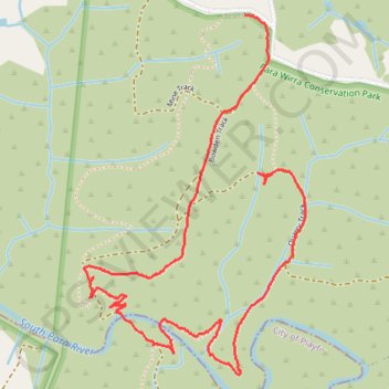
Thank you for supporting this site ❤️
Make a donation
Make a donation
Gear up for your next adventure:
As an Amazon Associate, this site earns from qualifying purchases at no extra cost to you.
Lady Pearce Circuit
Interactive trail map
Thank you for supporting this site ❤️
Make a donation
Make a donation
Gear up for your next adventure:
As an Amazon Associate, this site earns from qualifying purchases at no extra cost to you.
Trail profile
- Distance: 3.0 mi
- Elevation gain: 551 ft
- Maximum elevation: 902 ft
- Elevation loss: 463 ft
- Minimum elevation: 459 ft
- Moving time: 1 h 14 m
- Moving speed: 2.4 mph
- Maximum speed: 4.0 mph
- Total time: 1 h 24 m
- Global speed: 2.1 mph
Thank you for supporting this site ❤️
Make a donation
Make a donation
Gear up for your next adventure:
As an Amazon Associate, this site earns from qualifying purchases at no extra cost to you.
About this trail
Name: Lady Pearce Circuit trail, distance, elevation, map, profile, GPS track
Coordinates: -34.67031 138.81952 -34.65642 138.82990
Thank you for supporting this site ❤️
Make a donation
Make a donation
Gear up for your next adventure:
As an Amazon Associate, this site earns from qualifying purchases at no extra cost to you.
Other hiking, mountain biking, running and outdoor activity trails
Click on a trail to view its statistics, map and profile.