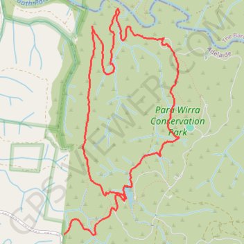
Devils Nose Track - Quarry Track Loop
Interactive trail map
Trail profile
- Distance: 6.2 mi
- Elevation gain: 889 ft
- Maximum elevation: 1,047 ft
- Elevation loss: 804 ft
- Minimum elevation: 515 ft
- Moving time: 1 h 40 m
- Moving speed: 3.7 mph
- Maximum speed: 33.2 mph
- Total time: 1 h 46 m
- Global speed: 3.5 mph
About this trail
Name: Devils Nose Track - Quarry Track Loop trail, distance, elevation, map, profile, GPS track
Start: Lake Road West, Adelaide, City of Playford, South Australia, Australia (-34.69067 138.82380)
End: Para Wirra Drive, Adelaide, City of Playford, South Australia, Australia (-34.69458 138.81565)
Coordinates: -34.69465 138.81565 -34.66918 138.83142
Other hiking, mountain biking, running and outdoor activity trails
Click on a trail to view its statistics, map and profile.