Import a GPX file

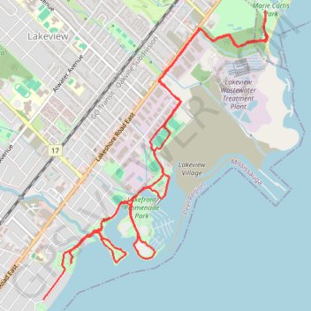
Toronto - Lake Ontario

#Hiking #Loop #Toronto #Ontario

  • Distance: 7.4 mi
  • Elevation gain: 203 ft
  • Maximum elevation: 285 ft
  • Elevation loss: 203 ft
  • Minimum elevation: 240 ft

Interactive trail map

Trail profile

  • Distance: 7.4 mi
  • Elevation gain: 203 ft
  • Maximum elevation: 285 ft
  • Elevation loss: 203 ft
  • Minimum elevation: 240 ft

About this trail

Other hiking, mountain biking, running and outdoor activity trails

Click on a trail to view its statistics, map and profile.

Québec - Montréal - Saint-Laurent River - Lake Ontario - Niagara Falls

Canada > Quebec > Urban agglomeration of Québec > Quebec

#Bike #Ontario

Distance: 670.1 mi • Elevation gain: 15,761 ft • Maximum elevation: 686 ft

Toronto - Martin Goodman Trail - Waterfront Trail

Canada > Ontario > Old Toronto

Lake Ontario. #Bike #Toronto #Ontario

Distance: 9.3 mi • Elevation gain: 243 ft • Maximum elevation: 285 ft

Toronto - Niagara Falls

Canada > Ontario > Old Toronto

Lake Ontario. #Hiking #Loop #Ontario #Toronto #Niagara

Distance: 182.6 mi • Elevation gain: 4,921 ft • Maximum elevation: 659 ft

Hamilton - Toronto

Canada > Ontario > Hamilton

#Bike

Distance: 50.5 mi • Elevation gain: 1,503 ft • Maximum elevation: 364 ft

Gear up for your next adventure:

📚Navigation Handbooks - Master the art of reading topographic maps and using a compass
🛡️Insect Repellent - Protection against bugs during outdoor activities
🦟Ultrasonic Repellers - Create a bug-free zone at your camp or rest stop
🧭Map Reading Tools - Tools and kits for map navigation
🔭Stargazing Telescopes - Perfect for camping in low-light pollution areas shown on maps

As an Amazon Associate, this site earns from qualifying purchases at no extra cost to you.