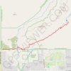
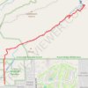
Seven Falls via Bear Canyon Trail in Pusch Ridge Wilderness
The Bear Canyon Trail to Seven Falls offers hikers a captivating journey through the Sonoran Desert's diverse landscapes. Along the path alongside Bear Creek, you'll encounter towering saguaros stand sentinel amidst a variety of cacti, navigate through rocky terrains and ascend gentle inclines, all leading to the cascading waters of Seven Falls. This trail provides a rewarding experience for those seeking a moderate hike amidst Arizona's natural beauty. #Hiking #Desert #Waterfall #Nature
- Distance: 7.0 mi
- Elevation gain: 1,142 ft
- Maximum elevation: 3,442 ft
- Elevation loss: 1,142 ft
- Minimum elevation: 2,651 ft
- Moving time: 2 h 48 m
- Moving speed: 2.5 mph
- Maximum speed: 3.5 mph
- Total time: 3 h 36 m
- Global speed: 1.9 mph
Interactive trail map
Trail profile
- Distance: 7.0 mi
- Elevation gain: 1,142 ft
- Maximum elevation: 3,442 ft
- Elevation loss: 1,142 ft
- Minimum elevation: 2,651 ft
- Moving time: 2 h 48 m
- Moving speed: 2.5 mph
- Maximum speed: 3.5 mph
- Total time: 3 h 36 m
- Global speed: 1.9 mph
About this trail
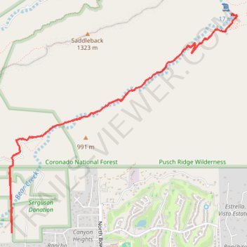
Name: Seven Falls via Bear Canyon Trail in Pusch Ridge Wilderness trail, distance, elevation, map, profile, GPS track
Start: 5182, North Bear Canyon Road, Pima County, Arizona, 85749, United States (32.30118 -110.80240)
End: 5181, North Bear Canyon Road, Pima County, Arizona, 85749, United States (32.30114 -110.80236)
Coordinates: 32.30114 -110.80276 32.32762 -110.77008
Topography: Pima County topographic map, elevation, terrain
Other hiking, mountain biking, running and outdoor activity trails
Click on a trail to view its statistics, map and profile.
Saddleback via Phoneline Trail and Blackett's Ridge Trail in Pusch Ridge Wilderness
United States > Arizona > Pima County
Hiking to Saddleback offers a rugged adventure amidst the stunning desert landscape of Tucson, Arizona. Along the route, hikers are treated to expansive views of Sabino Canyon and Bear Canyon, with striking features like towering saguaro cacti, prickly pear, and diverse birdlife. The challenging ascents…
Distance: 5.6 mi • Elevation gain: 1,896 ft • Maximum elevation: 4,377 ft