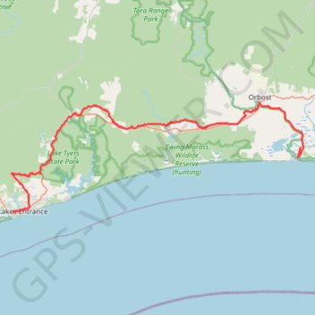
Lakes Entrance - Lake Tyers State Park - Marlo
Interactive trail map
Trail profile
- Distance: 52.9 mi
- Elevation gain: 2,890 ft
- Maximum elevation: 341 ft
- Elevation loss: 2,887 ft
- Minimum elevation: -7 ft
About this trail
Name: Lakes Entrance - Lake Tyers State Park - Marlo trail, distance, elevation, map, profile, GPS track
End: Old Marlo Road, Marlo, Shire of East Gippsland, Victoria, 3888, Australia (-37.78079 148.53503)
Coordinates: -37.88107 147.97299 -37.71259 148.53970
Other hiking, mountain biking, running and outdoor activity trails
Click on a trail to view its statistics, map and profile.
Bairnsdale - Lakes Entrance
Australia > Victoria > Bairnsdale
#Bike
Distance: 23.9 mi • Elevation gain: 1,043 ft • Maximum elevation: 299 ft