Make a donation
Gear up for your next adventure:
As an Amazon Associate, this site earns from qualifying purchases at no extra cost to you.
Killington Peak
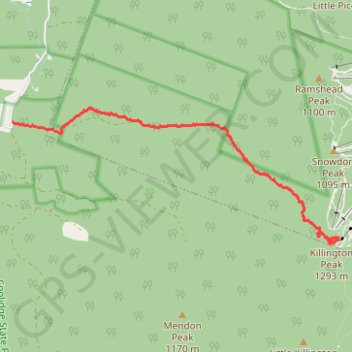
Hike from Brewers Corner to the Killington Peak via Bucklin Trail and the Brewers Brook in the Rutland City Forest, the Coolidge State Forest and the Green Mountain National Forest. #Hiking #Mountain #Forest #Nature
- Distance: 4.2 mi
- Elevation gain: 2,421 ft
- Maximum elevation: 4,193 ft
- Elevation loss: 95 ft
- Minimum elevation: 1,804 ft
- Moving time: 1 h 50 m
- Moving speed: 2.3 mph
- Maximum speed: 8.2 mph
- Total time: 2 h 6 m
- Global speed: 2.0 mph
Interactive trail map
Make a donation
Gear up for your next adventure:
As an Amazon Associate, this site earns from qualifying purchases at no extra cost to you.
Trail profile
- Distance: 4.2 mi
- Elevation gain: 2,421 ft
- Maximum elevation: 4,193 ft
- Elevation loss: 95 ft
- Minimum elevation: 1,804 ft
- Moving time: 1 h 50 m
- Moving speed: 2.3 mph
- Maximum speed: 8.2 mph
- Total time: 2 h 6 m
- Global speed: 2.0 mph
Make a donation
Gear up for your next adventure:
As an Amazon Associate, this site earns from qualifying purchases at no extra cost to you.
About this trail
Name: Killington Peak trail, distance, elevation, map, profile, GPS track
Coordinates: 43.60426 -72.87651 43.62155 -72.81882
Topography: Rutland County topographic map, elevation, terrain
Make a donation
Gear up for your next adventure:
As an Amazon Associate, this site earns from qualifying purchases at no extra cost to you.
Other hiking, mountain biking, running and outdoor activity trails
Click on a trail to view its statistics, map and profile.