Mima Falls MTB ride
Mountain bike ride in Capitol State Forest
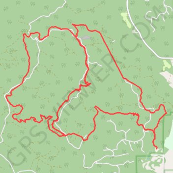
- Distance: 18.1 mi
- Elevation gain: 3,186 ft
- Maximum elevation: 1,266 ft
- Elevation loss: 3,199 ft
- Minimum elevation: 299 ft
- Moving time: 2 h 48 m
- Moving speed: 6.4 mph
- Maximum speed: 16.0 mph
- Total time: 3 h 37 m
- Global speed: 5.0 mph
Interactive trail map
Trail profile
- Distance: 18.1 mi
- Elevation gain: 3,186 ft
- Maximum elevation: 1,266 ft
- Elevation loss: 3,199 ft
- Minimum elevation: 299 ft
- Moving time: 2 h 48 m
- Moving speed: 6.4 mph
- Maximum speed: 16.0 mph
- Total time: 3 h 37 m
- Global speed: 5.0 mph
About this trail
Name: Mima Falls MTB ride trail, distance, elevation, map, profile, GPS track
Start: Mima Falls East, Thurston County, Washington, United States (46.90486 -123.06515)
End: Mima Falls Trailhead, Thurston County, Washington, United States (46.90346 -123.06416)
Coordinates: 46.90346 -123.12146 46.93616 -123.06022
Topography: Thurston County topographic map, elevation, terrain
Other hiking, mountain biking, running and outdoor activity trails
Click on a trail to view its statistics, map and profile.