Lost Valley - Capitol State Forest
Interactive trail map
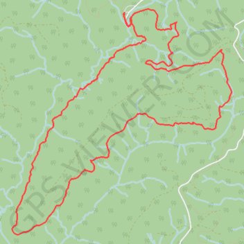
Trail profile
- Distance: 8.0 mi
- Elevation gain: 1,732 ft
- Maximum elevation: 1,260 ft
- Elevation loss: 1,736 ft
- Minimum elevation: 505 ft
About this trail
Name: Lost Valley - Capitol State Forest trail, distance, elevation, map, profile, GPS track
Start: Greenline, Thurston County, Washington, United States (46.93759 -123.13136)
End: Greenline, Thurston County, Washington, United States (46.93756 -123.13135)
Coordinates: 46.91218 -123.15022 46.93809 -123.11327
Topography: Thurston County topographic map, elevation, terrain
Other hiking, mountain biking, running and outdoor activity trails
Click on a trail to view its statistics, map and profile.
Mima Falls MTB ride
United States > Washington > Thurston County
Mountain bike ride in Capitol State Forest
Distance: 18.1 mi • Elevation gain: 3,186 ft • Maximum elevation: 1,266 ft