Savage Alpine Loop Trail in Denali National Park
The Savage Alpine Loop Trail is a delightful journey filled with breathtaking views that will leave you awestruck! As you meander along the rocky paths, you'll be treated to sweeping panoramas of Denali, especially at the scenic overlooks that reveal the majestic snow-capped peak and the lush Savage River below. Keep your eyes peeled for wildlife, too—Dall sheep and moose might just cross your path, making this adventure a feast for the senses. #Hiking #Mountain #Loop #River #Forest #Nature
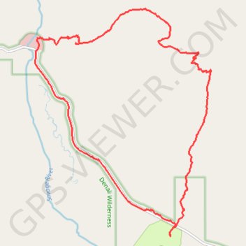
- Distance: 6.7 mi
- Elevation gain: 1,722 ft
- Maximum elevation: 4,144 ft
- Elevation loss: 1,729 ft
- Minimum elevation: 2,579 ft
- Moving time: 3 h 15 m
- Moving speed: 2.1 mph
- Maximum speed: 5.3 mph
- Total time: 4 h 14 m
- Global speed: 1.6 mph
Interactive trail map
Trail profile
- Distance: 6.7 mi
- Elevation gain: 1,722 ft
- Maximum elevation: 4,144 ft
- Elevation loss: 1,729 ft
- Minimum elevation: 2,579 ft
- Moving time: 3 h 15 m
- Moving speed: 2.1 mph
- Maximum speed: 5.3 mph
- Total time: 4 h 14 m
- Global speed: 1.6 mph
About this trail
Name: Savage Alpine Loop Trail in Denali National Park trail, distance, elevation, map, profile, GPS track
Start: Savage Campground, Denali Park Road, Denali, Alaska, United States (63.71623 -149.25510)
End: Savage Campground, Denali Park Road, Denali, Alaska, United States (63.71590 -149.25486)
Coordinates: 63.71582 -149.29227 63.74356 -149.24385
Topography: Denali topographic map, elevation, terrain
Other hiking, mountain biking, running and outdoor activity trails
Click on a trail to view its statistics, map and profile.
Road Trip Alaska 2018
United States > Alaska > Anchorage
From Anchorage.
Distance: 398.7 mi • Elevation gain: 15,719 ft • Maximum elevation: 2,425 ft