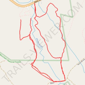
Bartlett Nordic Trails
- Distance: 4.7 mi
- Elevation gain: 374 ft
- Maximum elevation: 912 ft
- Elevation loss: 358 ft
- Minimum elevation: 722 ft
- Moving time: 39 m 31 s
- Moving speed: 7.1 mph
- Maximum speed: 10.6 mph
- Total time: 39 m 31 s
- Global speed: 7.1 mph
Interactive trail map
Trail profile
- Distance: 4.7 mi
- Elevation gain: 374 ft
- Maximum elevation: 912 ft
- Elevation loss: 358 ft
- Minimum elevation: 722 ft
- Moving time: 39 m 31 s
- Moving speed: 7.1 mph
- Maximum speed: 10.6 mph
- Total time: 39 m 31 s
- Global speed: 7.1 mph
About this trail
Name: Bartlett Nordic Trails trail, distance, elevation, map, profile, GPS track
Start: Bartlett, Carroll County, New Hampshire, 03812, United States (44.07149 -71.30079)
End: Main Street, Bartlett, Carroll County, New Hampshire, 03812, United States (44.07128 -71.30299)
Coordinates: 44.06148 -71.30323 44.07384 -71.29325
Topography: Carroll County topographic map, elevation, terrain
Other hiking, mountain biking, running and outdoor activity trails
Click on a trail to view its statistics, map and profile.