Oyster Dome Trail via Samish Bay Connector in Blanchard State Forest
The Oyster Dome Trail offers a scenic and moderately challenging hike with rewarding views throughout. Starting from Samish Overlook, the route ascends through lush vegetation, including towering Douglas firs and cedar trees, leading hikers past impressive remnants of historical logging. Upon reaching the summit, panoramic views unfold, including Samish Bay, the San Juan Islands, and on clear days, even Vancouver Island. The summit's rocky outcrop makes for a perfect rest spot, with sweeping vistas of the surrounding coastal and mountain landscapes. #Hiking #Forest #Nature #Coas #Sea #Overlook
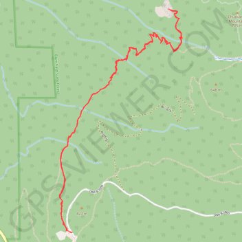
- Distance: 4.3 mi
- Elevation gain: 1,214 ft
- Maximum elevation: 1,991 ft
- Elevation loss: 1,175 ft
- Minimum elevation: 1,122 ft
- Moving time: 2 h 24 s
- Moving speed: 2.2 mph
- Maximum speed: 4.6 mph
- Total time: 2 h 43 m
- Global speed: 1.6 mph
Interactive trail map
Trail profile
- Distance: 4.3 mi
- Elevation gain: 1,214 ft
- Maximum elevation: 1,991 ft
- Elevation loss: 1,175 ft
- Minimum elevation: 1,122 ft
- Moving time: 2 h 24 s
- Moving speed: 2.2 mph
- Maximum speed: 4.6 mph
- Total time: 2 h 43 m
- Global speed: 1.6 mph
About this trail
Name: Oyster Dome Trail via Samish Bay Connector in Blanchard State Forest trail, distance, elevation, map, profile, GPS track
Start: Chuckanut Trail, Samish, Skagit County, Washington, United States (48.61011 -122.42684)
End: DNR B-2000, Samish, Skagit County, Washington, United States (48.60999 -122.42614)
Coordinates: 48.60997 -122.42762 48.62692 -122.41353
Topography: Skagit County topographic map, elevation, terrain
Other hiking, mountain biking, running and outdoor activity trails
Click on a trail to view its statistics, map and profile.
Oyster Dome Trail in Blanchard State Forest
United States > Washington > Skagit County > Samish
The Oyster Dome Trail, accessed via Chuckanut Drive and the Samish Bay Connector, offers hikers a rewarding journey through Blanchard State Forest. The path meanders through lush forests of alder, cedar, and Douglas fir, with occasional views of the Salish Sea and the Olympic Peninsula. The trail culminates at…
Distance: 6.7 mi • Elevation gain: 2,014 ft • Maximum elevation: 1,991 ft
Oyster Dome loop hike via Lily Lake from Samish Overlook
United States > Washington > Skagit County > Samish
Distance: 6.6 mi • Elevation gain: 1,411 ft • Maximum elevation: 2,077 ft
Oyster Dome via Chuckanut Trail and Samish Bay Connector in Blanchard State Forest
United States > Washington > Skagit County > Samish
The hike to Oyster Dome is a rewarding journey through the serene Blanchard State Forest. The route begins with steady switchbacks, winding through a lush canopy of Douglas fir, maple, and cedar, offering moments of tranquility punctuated by expansive views over Samish Bay. Upon reaching the rocky summit,…
Distance: 6.2 mi • Elevation gain: 1,988 ft • Maximum elevation: 1,982 ft