Glen Creek Gorge Loop via Gorge Trail and Indian Trail in Watkins Glen State Park
The Glen Creek Gorge Loop offers a captivating hiking experience through a stunning landscape of waterfalls, narrow gorges, and unique rock formations. As you traverse the Gorge Trail, highlights include the dramatic Sentry Bridge and the enchanting Cavern Cascade, where the trail actually takes you behind the waterfall for a unique view. The return journey along the Indian Trail provides a contrasting perspective, featuring scenic overlooks and a tranquil forest atmosphere, making this loop a well-rounded adventure for nature lovers. #Hiking #Loop #Gorge #Canyon #Waterfall #River #Forest #Nature
- Distance: 2.4 mi
- Elevation gain: 453 ft
- Maximum elevation: 974 ft
- Elevation loss: 397 ft
- Minimum elevation: 545 ft
- Moving time: 1 h 6 m
- Moving speed: 2.2 mph
- Maximum speed: 13.6 mph
- Total time: 1 h 23 m
- Global speed: 1.7 mph
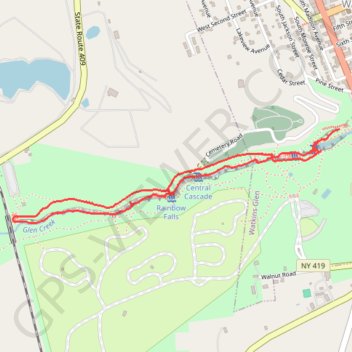
Interactive trail map
Trail profile
- Distance: 2.4 mi
- Elevation gain: 453 ft
- Maximum elevation: 974 ft
- Elevation loss: 397 ft
- Minimum elevation: 545 ft
- Moving time: 1 h 6 m
- Moving speed: 2.2 mph
- Maximum speed: 13.6 mph
- Total time: 1 h 23 m
- Global speed: 1.7 mph
About this trail
Name: Glen Creek Gorge Loop via Gorge Trail and Indian Trail in Watkins Glen State Park trail, distance, elevation, map, profile, GPS track
Coordinates: 42.37148 -76.89177 42.37559 -76.87254
Topography: Schuyler County topographic map, elevation, terrain
Other hiking, mountain biking, running and outdoor activity trails
Click on a trail to view its statistics, map and profile.
Indian Trail in Watkins Glen State Park
United States > New York > Schuyler County > Watkins Glen
The Indian Trail in Watkins Glen State Park offers a more peaceful route compared to the park's main gorge trail. It meanders along the north rim of the gorge, providing distant views of the impressive rock formations and waterfalls like Rainbow Falls below. Notably, hikers will cross a suspension bridge,…
Distance: 2.4 mi • Elevation gain: 492 ft • Maximum elevation: 978 ft
Indian Trail and Finger Lakes/North Country Trail Loop in Watkins Glen State Park
United States > New York > Schuyler County > Town of Dix
The Indian Trail and Finger Lakes/North Country Trail Loop in Watkins Glen State Park showcases the park's diverse landscapes, from dramatic gorges to serene woodland paths. Hikers are treated to breathtaking views of the winding Glen Creek and cascading waterfalls, including the renowned Rainbow Falls,…
Distance: 4.6 mi • Elevation gain: 761 ft • Maximum elevation: 1,040 ft