Holy Jim Falls
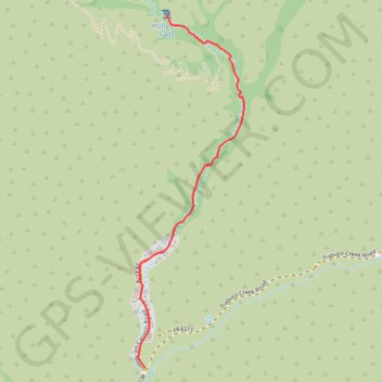
Interactive trail map
Trail profile
- Distance: 1.6 mi
- Elevation gain: 725 ft
- Maximum elevation: 2,461 ft
- Elevation loss: 16 ft
- Minimum elevation: 1,745 ft
About this trail
Name: Holy Jim Falls trail, distance, elevation, map, profile, GPS track
Start: 1, Holy Jim Canyon Road, Orange County, California, 92678, United States (33.67706 -117.51712)
End: Holy Jim Hiking Trail, Orange County, California, United States (33.69438 -117.51582)
Coordinates: 33.67706 -117.51752 33.69438 -117.51131
Topography: Orange County topographic map, elevation, terrain
Other hiking, mountain biking, running and outdoor activity trails
Click on a trail to view its statistics, map and profile.