Thank you for supporting this site ❤️
Make a donation
Make a donation
Gear up for your next adventure:
As an Amazon Associate, this site earns from qualifying purchases at no extra cost to you.
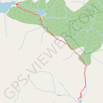
Owl-Tenquille traverse south of Ogre Lake
- Distance: 2.3 mi
- Elevation gain: 384 ft
- Maximum elevation: 5,965 ft
- Elevation loss: 774 ft
- Minimum elevation: 5,430 ft
- Moving time: 1 h 33 m
- Moving speed: 1.5 mph
- Maximum speed: 3.4 mph
- Total time: 2 h 55 m
- Global speed: 0.8 mph
Interactive trail map
Thank you for supporting this site ❤️
Make a donation
Make a donation
Gear up for your next adventure:
As an Amazon Associate, this site earns from qualifying purchases at no extra cost to you.
Trail profile
- Distance: 2.3 mi
- Elevation gain: 384 ft
- Maximum elevation: 5,965 ft
- Elevation loss: 774 ft
- Minimum elevation: 5,430 ft
- Moving time: 1 h 33 m
- Moving speed: 1.5 mph
- Maximum speed: 3.4 mph
- Total time: 2 h 55 m
- Global speed: 0.8 mph
Thank you for supporting this site ❤️
Make a donation
Make a donation
Gear up for your next adventure:
As an Amazon Associate, this site earns from qualifying purchases at no extra cost to you.
About this trail
Name: Owl-Tenquille traverse south of Ogre Lake trail, distance, elevation, map, profile, GPS track
Coordinates: 50.46855 -122.85759 50.48634 -122.83683
Thank you for supporting this site ❤️
Make a donation
Make a donation
Gear up for your next adventure:
As an Amazon Associate, this site earns from qualifying purchases at no extra cost to you.
Other hiking, mountain biking, running and outdoor activity trails
Click on a trail to view its statistics, map and profile.