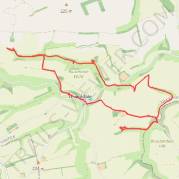
Thixendale Loop
- Distance: 9.5 mi
- Elevation gain: 1,299 ft
- Maximum elevation: 692 ft
- Elevation loss: 1,302 ft
- Minimum elevation: 348 ft
- Moving time: 2 h 3 m
- Moving speed: 4.6 mph
- Maximum speed: 8.8 mph
- Total time: 2 h 7 m
- Global speed: 4.5 mph
Interactive trail map
Trail profile
- Distance: 9.5 mi
- Elevation gain: 1,299 ft
- Maximum elevation: 692 ft
- Elevation loss: 1,302 ft
- Minimum elevation: 348 ft
- Moving time: 2 h 3 m
- Moving speed: 4.6 mph
- Maximum speed: 8.8 mph
- Total time: 2 h 7 m
- Global speed: 4.5 mph
About this trail
Name: Thixendale Loop trail, distance, elevation, map, profile, GPS track
Coordinates: 54.03086 -0.74383 54.05099 -0.67570
Other hiking, mountain biking, running and outdoor activity trails
Click on a trail to view its statistics, map and profile.
East Riding of Yorkshire Trail Running
United Kingdom > England > East Riding of Yorkshire
Distance: 20.8 mi • Elevation gain: 1,657 ft • Maximum elevation: 771 ft
Fridaythorpe Loop Trail Running
United Kingdom > England > East Riding of Yorkshire > Fridaythorpe
Distance: 9.7 mi • Elevation gain: 883 ft • Maximum elevation: 709 ft
Acklam loop
United Kingdom > England > North Yorkshire > Norton-on-Derwent
Distance: 21.6 mi • Elevation gain: 1,808 ft • Maximum elevation: 778 ft