EPIC200 2021_100KM_edit7_6
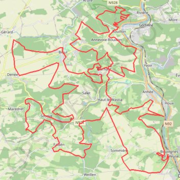
<p>De: RAVeL L150, Maredsous, Anhée, Namur, Wallonie<br/>
À: RAVeL L150, Maredsous, Anhée, Namur, Wallonie</p>
<p>Routage: Le plus court - OSM, Manuellement</p>
- Distance: 63.0 mi
- Elevation gain: 7,100 ft
- Maximum elevation: 879 ft
- Elevation loss: 7,100 ft
- Minimum elevation: 302 ft
Interactive trail map
Trail profile
- Distance: 63.0 mi
- Elevation gain: 7,100 ft
- Maximum elevation: 879 ft
- Elevation loss: 7,100 ft
- Minimum elevation: 302 ft
About this trail
Name: EPIC200 2021_100KM_edit7_6 trail, distance, elevation, map, profile, GPS track
Coordinates: 50.26055 4.74882 50.36139 4.89710
Other hiking, mountain biking, running and outdoor activity trails
Click on a trail to view its statistics, map and profile.
Eurovelo 15 - Strasbourg Rotterdam
France > Grand Est > Bas-Rhin > Strasbourg
Distance: 554.1 mi • Elevation gain: 6,903 ft • Maximum elevation: 479 ft