Make a donation
Gear up for your next adventure:
As an Amazon Associate, this site earns from qualifying purchases at no extra cost to you.
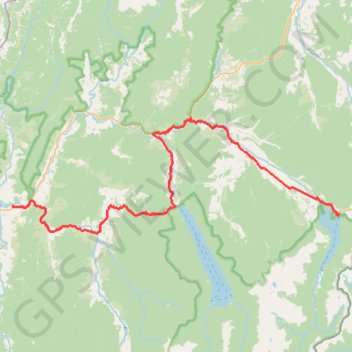
Saint Arnaud - Murchison
Interactive trail map
Make a donation
Gear up for your next adventure:
As an Amazon Associate, this site earns from qualifying purchases at no extra cost to you.
Trail profile
- Distance: 45.2 mi
- Elevation gain: 2,336 ft
- Maximum elevation: 2,169 ft
- Elevation loss: 3,825 ft
- Minimum elevation: 564 ft
Make a donation
Gear up for your next adventure:
As an Amazon Associate, this site earns from qualifying purchases at no extra cost to you.
About this trail
Name: Saint Arnaud - Murchison trail, distance, elevation, map, profile, GPS track
Start: Kerr Bay Campsite, Lake Road, Saint Arnaud, 7053, New Zealand (-41.80587 172.84745)
End: Riverview Holiday Park, Riverview Road, Murchison, 7007, New Zealand (-41.79590 172.34090)
Coordinates: -41.82681 172.34023 -41.69414 172.84745
Make a donation
Gear up for your next adventure:
As an Amazon Associate, this site earns from qualifying purchases at no extra cost to you.
Other hiking, mountain biking, running and outdoor activity trails
Click on a trail to view its statistics, map and profile.
Murchison - Reefton
#Bike
Distance: 75.9 mi • Elevation gain: 5,991 ft • Maximum elevation: 2,260 ft