Minnehaha Creek Loop Trail via Minnehaha Falls
The Minnehaha Creek Loop Trail offers a serene, accessible urban hike with charming views and diverse landscapes within the heart of Minneapolis. Beginning near the iconic 53-foot Minnehaha Falls, the trail takes you through lush parkland, along a fast-moving creek, and down to the banks of the Mississippi River, where you can wade or enjoy the view. The route is welcoming to all skill levels, featuring scenic stretches, seasonal wildlife, and historical sites, making it a well-rounded, refreshing escape from city life. #Hiking #Waterfall #River #Loop #Forest #Nature
- Distance: 1.8 mi
- Elevation gain: 141 ft
- Maximum elevation: 820 ft
- Elevation loss: 141 ft
- Minimum elevation: 715 ft
- Moving time: 54 m 52 s
- Moving speed: 2.0 mph
- Maximum speed: 3.3 mph
- Total time: 59 m 19 s
- Global speed: 1.8 mph
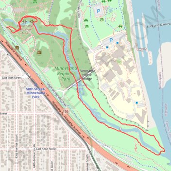
Interactive trail map
Trail profile
- Distance: 1.8 mi
- Elevation gain: 141 ft
- Maximum elevation: 820 ft
- Elevation loss: 141 ft
- Minimum elevation: 715 ft
- Moving time: 54 m 52 s
- Moving speed: 2.0 mph
- Maximum speed: 3.3 mph
- Total time: 59 m 19 s
- Global speed: 1.8 mph
About this trail
Name: Minnehaha Creek Loop Trail via Minnehaha Falls trail, distance, elevation, map, profile, GPS track
Coordinates: 44.90869 -93.21210 44.91578 -93.20072
Topography: Minneapolis topographic map, elevation, terrain