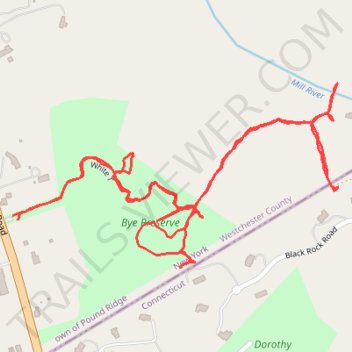
Bye Preserve
- Distance: 2.0 mi
- Elevation gain: 217 ft
- Maximum elevation: 518 ft
- Elevation loss: 217 ft
- Minimum elevation: 371 ft
- Moving time: 38 m 26 s
- Moving speed: 3.1 mph
- Maximum speed: 5.0 mph
- Total time: 41 m 11 s
- Global speed: 2.9 mph
Interactive trail map
Trail profile
- Distance: 2.0 mi
- Elevation gain: 217 ft
- Maximum elevation: 518 ft
- Elevation loss: 217 ft
- Minimum elevation: 371 ft
- Moving time: 38 m 26 s
- Moving speed: 3.1 mph
- Maximum speed: 5.0 mph
- Total time: 41 m 11 s
- Global speed: 2.9 mph
About this trail
Name: Bye Preserve trail, distance, elevation, map, profile, GPS track
Coordinates: 41.17704 -73.56547 41.18044 -73.55751
Topography: Westchester County topographic map, elevation, terrain
Other hiking, mountain biking, running and outdoor activity trails
Click on a trail to view its statistics, map and profile.