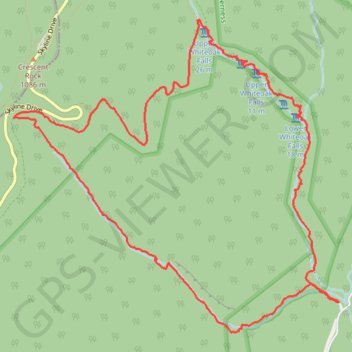
White Oak Falls and Cedar Run Falls Loop
Interactive trail map
Trail profile
- Distance: 8.8 mi
- Elevation gain: 2,438 ft
- Maximum elevation: 3,350 ft
- Elevation loss: 2,434 ft
- Minimum elevation: 1,119 ft
About this trail
Name: White Oak Falls and Cedar Run Falls Loop trail, distance, elevation, map, profile, GPS track
Coordinates: 38.53633 -78.38588 38.56477 -78.34808
Topography: Madison County topographic map, elevation, terrain
Other hiking, mountain biking, running and outdoor activity trails
Click on a trail to view its statistics, map and profile.
Loop hike via Weakley Hollow, White Oak Canyon, Hawksbill, Appalachian Trailand Old Rag in Shenandoah National Park
United States > Virginia > Madison County
Distance: 21.8 mi • Elevation gain: 4,744 ft • Maximum elevation: 3,993 ft