Gravel loop ride via Karawatha
- Distance: 37.5 mi
- Elevation gain: 2,034 ft
- Maximum elevation: 361 ft
- Elevation loss: 2,001 ft
- Minimum elevation: 13 ft
- Moving time: 4 h 5 m
- Moving speed: 9.2 mph
- Maximum speed: 29.3 mph
- Total time: 4 h 48 m
- Global speed: 7.8 mph
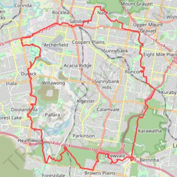
Interactive trail map
Trail profile
- Distance: 37.5 mi
- Elevation gain: 2,034 ft
- Maximum elevation: 361 ft
- Elevation loss: 2,001 ft
- Minimum elevation: 13 ft
- Moving time: 4 h 5 m
- Moving speed: 9.2 mph
- Maximum speed: 29.3 mph
- Total time: 4 h 48 m
- Global speed: 7.8 mph
About this trail
Name: Gravel loop ride via Karawatha trail, distance, elevation, map, profile, GPS track
Coordinates: -27.66023 152.98018 -27.54410 153.08782
Other hiking, mountain biking, running and outdoor activity trails
Click on a trail to view its statistics, map and profile.
Toohey Forest Loop
Australia > Queensland > City of Brisbane
Distance: 4.9 mi • Elevation gain: 607 ft • Maximum elevation: 361 ft
Mount Gravatt and Toohey Foret Loop
Australia > Queensland > Brisbane
Distance: 16.2 mi • Elevation gain: 2,575 ft • Maximum elevation: 614 ft
Dan Stiller Reserve Trail Run
Distance: 7.2 mi • Elevation gain: 374 ft • Maximum elevation: 157 ft
Brisbane - Karawatha
Distance: 13.8 mi • Elevation gain: 784 ft • Maximum elevation: 292 ft