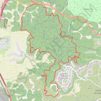
Ben-Shemen
Interactive trail map
Trail profile
- Distance: 13.0 mi
- Elevation gain: 1,670 ft
- Maximum elevation: 663 ft
- Elevation loss: 1,667 ft
- Minimum elevation: 292 ft
About this trail
Name: Ben-Shemen trail, distance, elevation, map, profile, GPS track
Start: Hevel Modiin Regional Council, Ramla Subdistrict, Center District, Israel (31.95060 34.95534)
Coordinates: 31.90811 34.94157 31.95215 34.97472
Other hiking, mountain biking, running and outdoor activity trails
Click on a trail to view its statistics, map and profile.
Ben Shemen Hertzel Blue Single
סינגל כחול משודרג ביער בן שמן
Distance: 6.8 mi • Elevation gain: 646 ft • Maximum elevation: 577 ft
מסלול חדש ומטורף. אהבתי.
Distance: 12.6 mi • Elevation gain: 932 ft • Maximum elevation: 466 ft