Post Canyon
#MTB
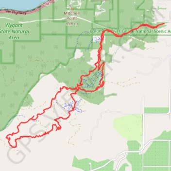
- Distance: 13.9 mi
- Elevation gain: 2,579 ft
- Maximum elevation: 2,444 ft
- Elevation loss: 2,602 ft
- Minimum elevation: 666 ft
- Moving time: 2 h 10 m
- Moving speed: 6.4 mph
- Maximum speed: 29.8 mph
- Total time: 2 h 49 m
- Global speed: 4.9 mph
Interactive trail map
Trail profile
- Distance: 13.9 mi
- Elevation gain: 2,579 ft
- Maximum elevation: 2,444 ft
- Elevation loss: 2,602 ft
- Minimum elevation: 666 ft
- Moving time: 2 h 10 m
- Moving speed: 6.4 mph
- Maximum speed: 29.8 mph
- Total time: 2 h 49 m
- Global speed: 4.9 mph
About this trail
Name: Post Canyon trail, distance, elevation, map, profile, GPS track
Start: 4559, Post Canyon Drive, Hood River County, Oregon, 97031, United States (45.69589 -121.57982)
End: 4550, Post Canyon Drive, Hood River County, Oregon, 97031, United States (45.69628 -121.57764)
Coordinates: 45.66200 -121.64032 45.69628 -121.57764
Topography: Hood River County topographic map, elevation, terrain
Other hiking, mountain biking, running and outdoor activity trails
Click on a trail to view its statistics, map and profile.
Northern part of the Pacific Crest Trail (PCT)
United States > Oregon > Klamath County
Hike on the Pacific Crest National Scenic Trail from Crater Lake to Canada Border through Oregon and Washington along the Sierra Nevada and Cascade mountain ranges. #Hiking #Mountain #SierraNevada #Cascade #Nature #Forest #Park #PCT
Distance: 744.6 mi • Elevation gain: 145,367 ft • Maximum elevation: 7,569 ft
MTB ride in Hood River
United States > Oregon > Hood River County
Distance: 11.1 mi • Elevation gain: 2,087 ft • Maximum elevation: 2,034 ft