Riding to Magpie Mine
- Distance: 8.6 mi
- Elevation gain: 407 ft
- Maximum elevation: 1,447 ft
- Elevation loss: 551 ft
- Minimum elevation: 1,237 ft
- Moving time: 41 m 6 s
- Moving speed: 12.6 mph
- Maximum speed: 27.4 mph
- Total time: 1 h 51 m
- Global speed: 4.6 mph
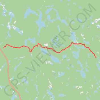
Interactive trail map
Trail profile
- Distance: 8.6 mi
- Elevation gain: 407 ft
- Maximum elevation: 1,447 ft
- Elevation loss: 551 ft
- Minimum elevation: 1,237 ft
- Moving time: 41 m 6 s
- Moving speed: 12.6 mph
- Maximum speed: 27.4 mph
- Total time: 1 h 51 m
- Global speed: 4.6 mph
About this trail
Name: Riding to Magpie Mine trail, distance, elevation, map, profile, GPS track
Coordinates: 48.21239 -84.85209 48.22692 -84.71463
Other hiking, mountain biking, running and outdoor activity trails
Click on a trail to view its statistics, map and profile.
White River - Wawa
Canada > Ontario > Algoma District > White River Township
#Bike #WhiteRiver #Wawa
Distance: 57.3 mi • Elevation gain: 1,837 ft • Maximum elevation: 1,545 ft